Nigel's ride across California My California sojourn had turned out to be an incredible one – fabulous roads, incredible scenery, faultless weather and no dramas... Pics: AdrenalinImages
With a couple of days to go before I was due to drop my rented BMW R 1200 RT back to its owner and head to the Royal Enfield Bear 650 launch, I was wondering which way to head back, and the options didn’t look great… Twisted California, Part 3…
My original plan had been to head West through Yosemite National Park and across to the coast to return to Los Angeles, but getting north out of LA slower than expected had me cancel Yosemite… then put it back on the agenda when I realised road works had closed the coastal highway. But by that time I was riding East to go through Yosemite, turning south when I exited the park and found myself at Bishop, California.
Read Twisted California Part 2 here and Part 1 here…
After a huge ride the previous day – over 12 hours start-to-stop – I wasn’t in hurry to get moving the next day, so I wandered up the main drag to a Starbucks in the hope of a decent coffee. The coffee was weak and expensive, but the conversation with the 94 year-old young man about the Isle of Man – he’d questioned me about my jacket, which I purchased there when I was at the Classic TT in 2013 – made the walk worthwhile.
Another American quite disillusioned with his country, he was finding joy in watching Isle of Man racing on television which could distract him from his inability to ride these days, his body not functioning in ways which made motorcycling possible.
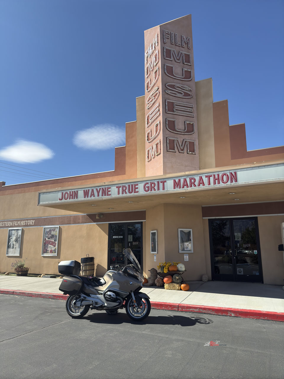
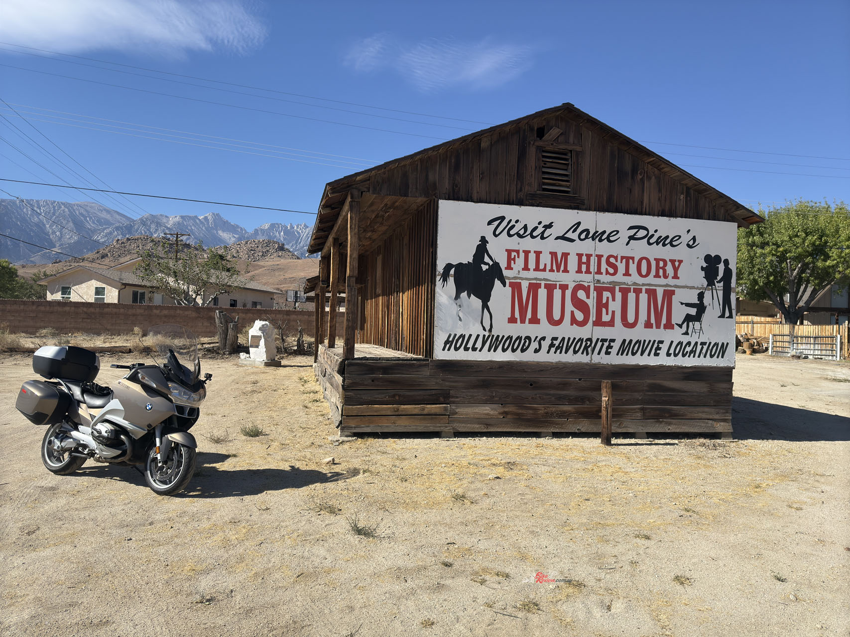
Lone Pine is a movie lot town… lots of movies have had at least some scenes shot in the area, Westerns of course but anything with a road trip in it…
Although Americans are individually often very friendly, I hadn’t met too many who weren’t selling me something, bringing me food or checking me into a motel, which I suppose is fairly normal when you’re a solo traveller in your 50s (and the introvert in me liked!).
After adding a little of the brewed coffee at my motel to the dirty milk Starbucks had sold me I bought a breakfast of yogurt and a banana from the supermarket – it’s a way to avoid the sugar and expense of a conventional American breakfast – I hit the road, heading south.
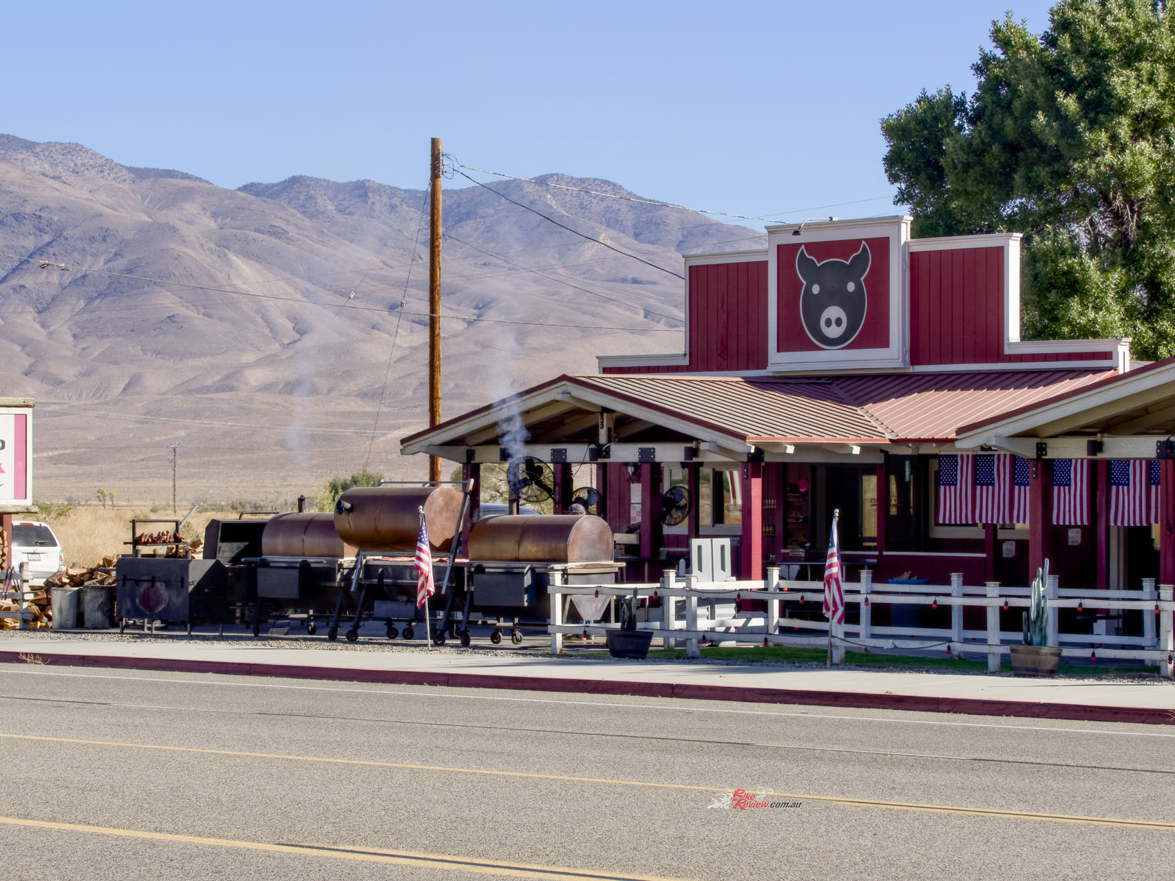
Outside Bishop I stopped to photograph the big BBQs cooking lunches… I so wanted to stay for lunch, for slow-cooked American BBQ is a guilty pleasure of mine – but I’d enjoyed a serve of BBQ ribs the night before, splashing out on the local speciality.


So I rode on, through Big Pine and Independence, stopping at Lone Pine for coffee and cherry pie… believe me, in this area the food is more interesting than the road, which was straight and dull, although the desert-like landscape was pretty interesting.
Lone Pine is a movie lot town… lots of movies have had at least some scenes shot in the area, Westerns of course but anything with a road trip in it may have passed through Lone Pine. There was a cinema showing a John Wayne movie festival, a film history museum and numerous buildings and businesses which looked like they are straight out of Hollywood… because they are.
I found the Alabama Hills Cafe, and ordered a cherry pie… which was everything I was hoping for. Rich, sweet with a lovely crunch and topped with a mountain of whipped cream, this was an American guilty pleasure.
Rich, sweet with a lovely crunch and topped with a mountain of whipped cream, this was an American guilty pleasure…
I’d been wondering if there was a better route than straight back down the highway to Los Angeles, and a pair of Harley T-shirt wearing gents (there was a pair of Harleys outside, so I presumed they also rode) prompted me to ask for advice about the route.
“The road which goes out toward Death Valley, is that a better route than straight down the highway?, I asked. “Both roads are pretty boring”, came the reply from the Tall Man. “Not much there, but a bit less traffic, I suppose”. Tall Man then got up and headed toward the smallest room in the house, which gave his mate, Short Man, a chance to get a word in. “You’ll like the road through the park much better. It’ll only cost you maybe 15 minutes, but it’s well worth taking.” Short Man was so right.


Just south of Lone Pine is the turnoff for Highway 136 and soon after that I needed to find what we sometimes euphemistically call a public convenience, because a tree just wouldn’t do (and there was very few trees along the 136 anyway, but that was beside the point). So I turned into Keeler, which looked like being the only town for many miles (and was).
I wasn’t sure what I’d entered, but it was a bit spooky… the majority of the town appears abandoned, yet there was a smattering of modern vehicles and infrastructure that I knew it wasn’t – I even saw a couple of the town’s 71 residents, so it certainly isn’t deserted.
But why so much of the town was allowed to lie in ruins, slowly dissolving back into the desert landscape is another American mystery. Keeler has had its troubles over the years. At the back there’s an old mine processing facility, which was the major employer in the town, but it finally went broke for the last time in the 1950s. Los Angeles pinched all the water from the Owens Valley nearby (steamships once moved the locally mined silver) and the resulting alkali dust storms drove many residents away.


What I found were old vehicles allowed to simply sit on the side of the road, seemingly waiting for an owner who just isn’t coming back. And the Keeler Market, which doesn’t look like it’s sold a bag of flour in 70 years. Yet there was a motorhome parked near the old market building, yet another indication the place wasn’t abandoned.
There were no shops, no parks, no government buildings…
There were no shops, no parks, no government buildings… but I did find some new works, some temporary buildings with communications technology attached and it was here I was able to conclude the business which had seen me ride into Keeler California in the first place.


But for that toilet stop I would have sailed on past what turned out to be a fascinating place, a microcosm of change, a place where I felt hundreds of people had hoped would help them make their fortune, only to be driven away by natural disasters (1872 Lone Pine Earthquake), economics (the cessation of mining) and political expediency (the draining of the lake for water to Los Angeles).
I stopped again, not too far from Keeler, and got out the drone. The landscape was amazing, the basically dry Owens Lake combining with the rain-shadowed hills to give a moonscape-like tableau.
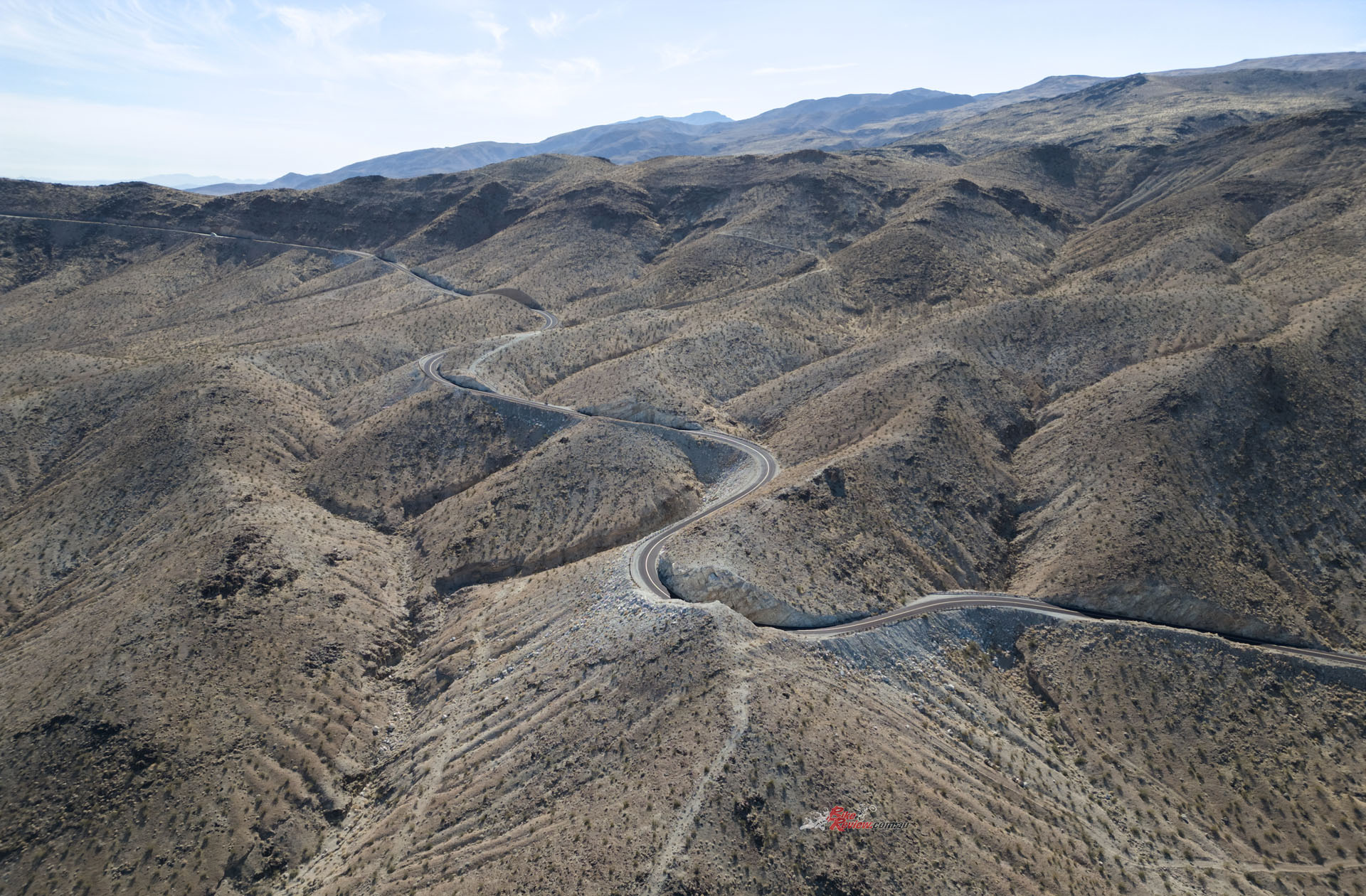
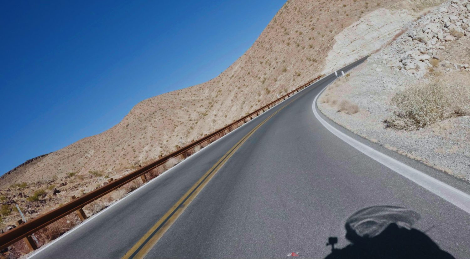
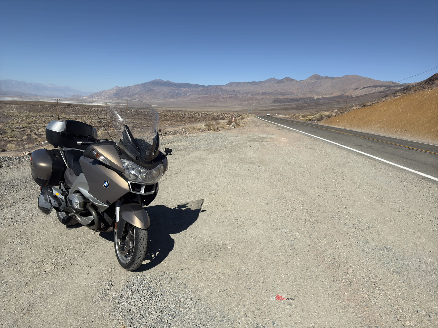
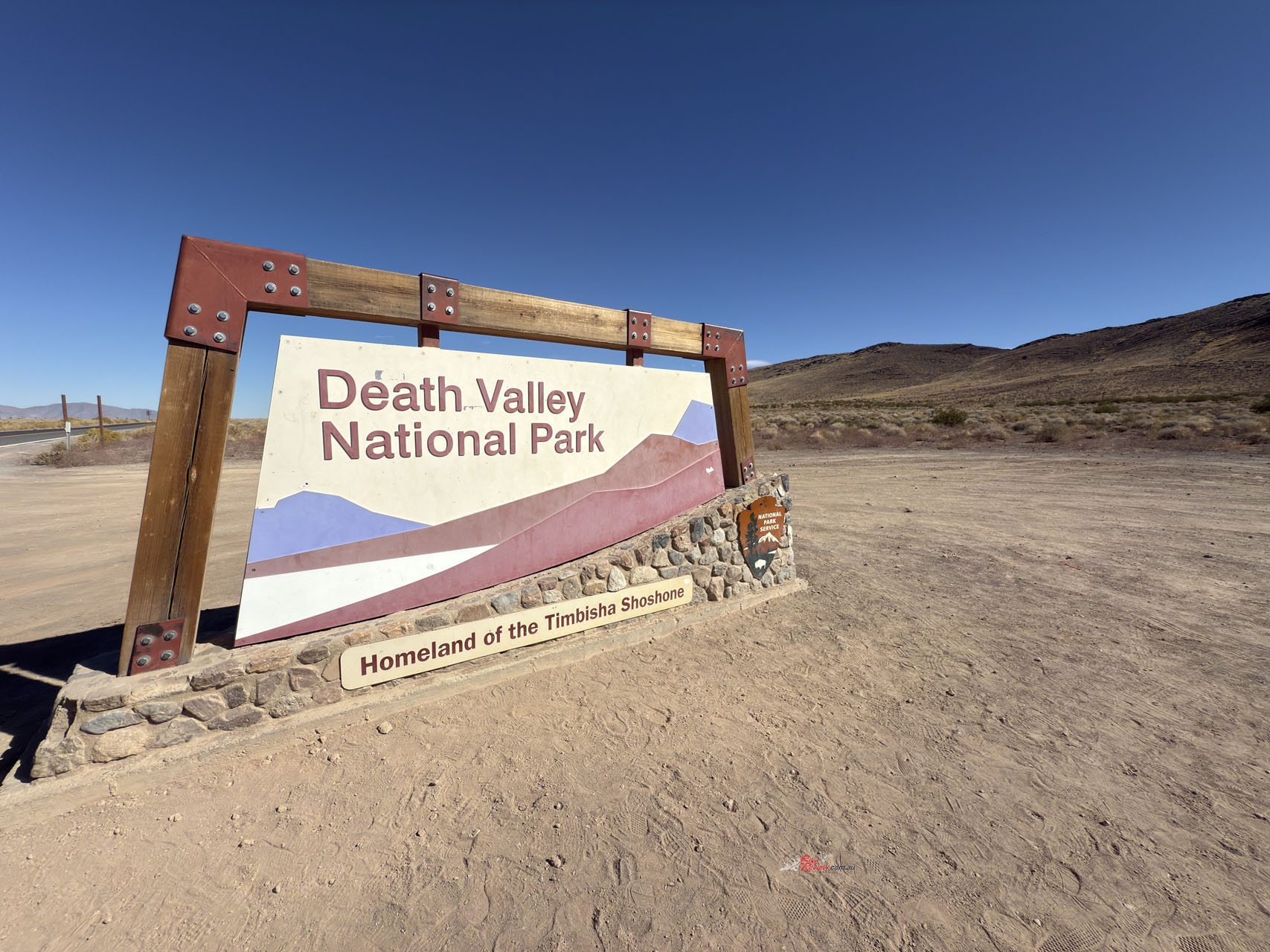
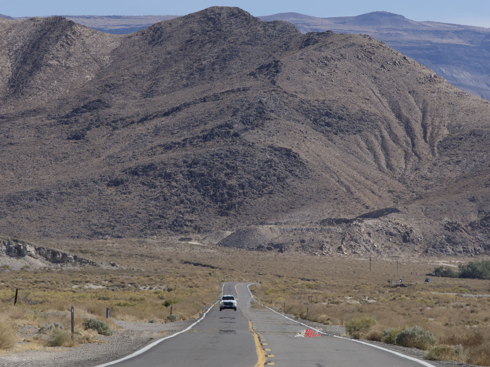
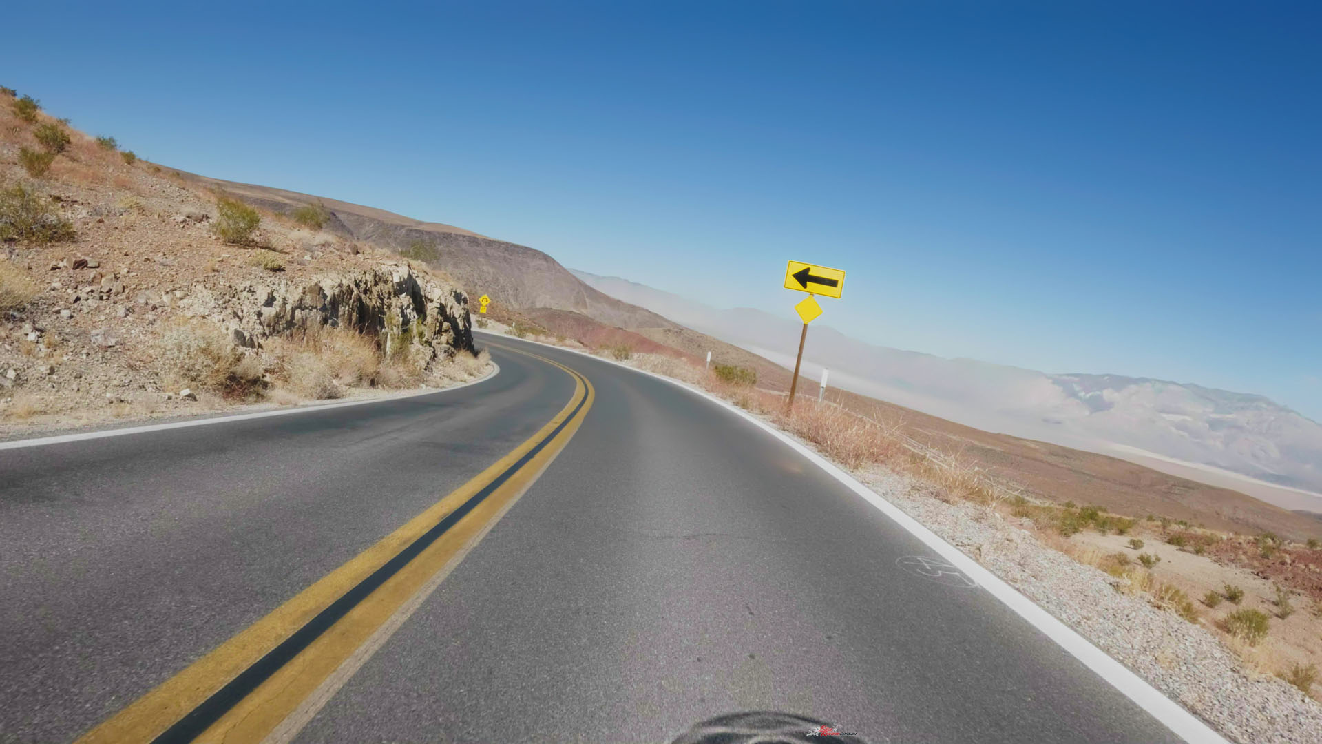
Not far from there I stopped at the Death Valley National Park sign and soon after was winding my way down into a valley on a racetrack-smooth, wide and little-trafficked highway… so much more fun than the four lane direct route to Los Angeles. I stopped for photos a few times, even walking up the side of one cliff to get a shot of the bike, road and dry valley in the distance.


The view of the landscape stretches out in every direction here, unobstructed. The lack of water is obvious, although there is evidence of water’s influence – especially in the valleys and canyons where water flow has changed the landscape itself.
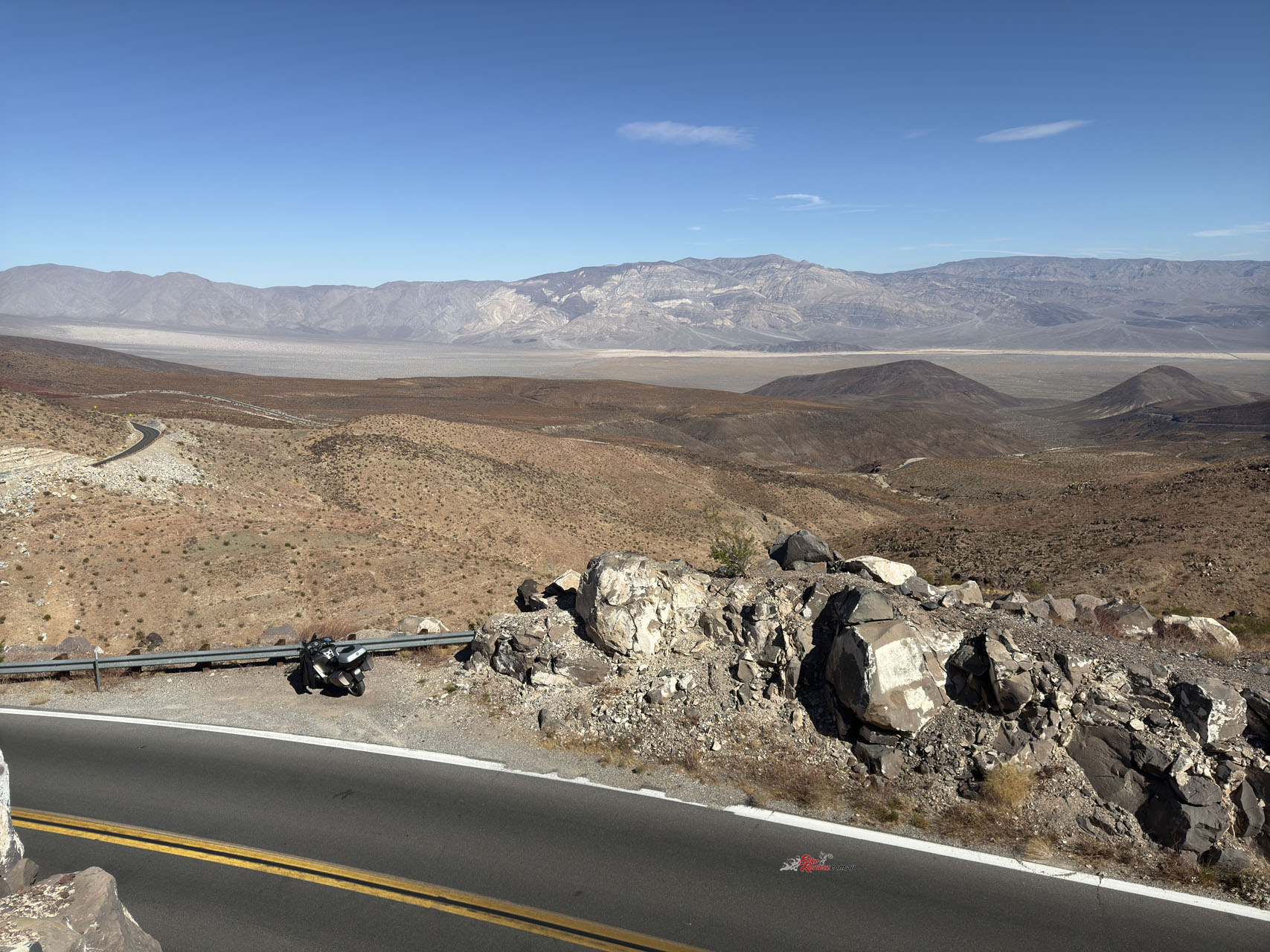
I wondered if the valley had once had a glacier push through it, but it turns out the place is known as a graben – a downdropped block of land between two mountain ranges, which goes some way to explaining why it has the lowest elevation in North America (86m below sea level) yet is only 136km from Mount Whitney, the highest point in mainland USA.
The valley walls on either side contribute to the lack of rain and heat, but are what makes Death Valley such an interesting place – the road winding down into the valley a fun ride with fabulous views.
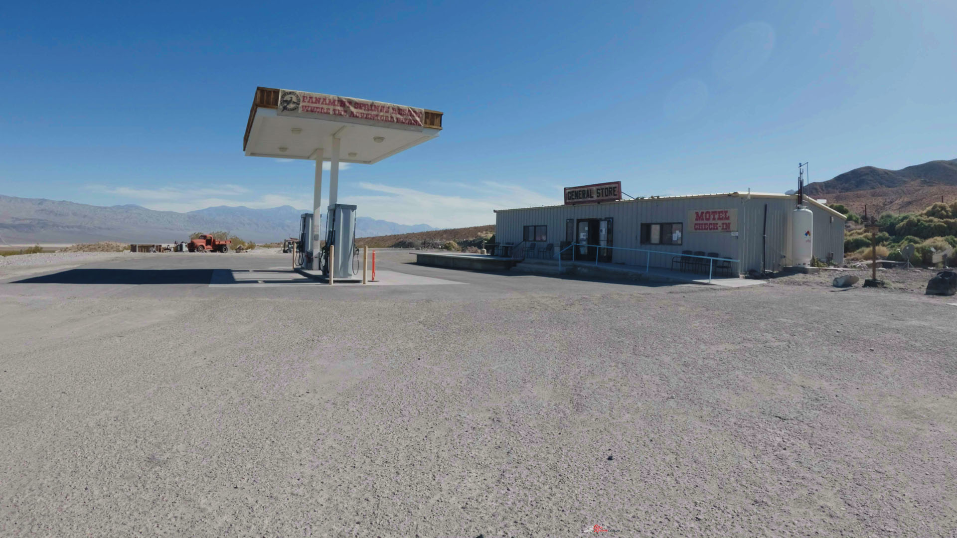
I would have loved to have visited Furnace Creek, the famous Death Valley town, but that would have added a lot of time to the trip and I needed to have the bike back in Los Angeles the following morning, so after refuelling at Panamint Springs – where there’s not a lot beyond the General Store/servo – I was back on the road and soon heading south along the valley floor.
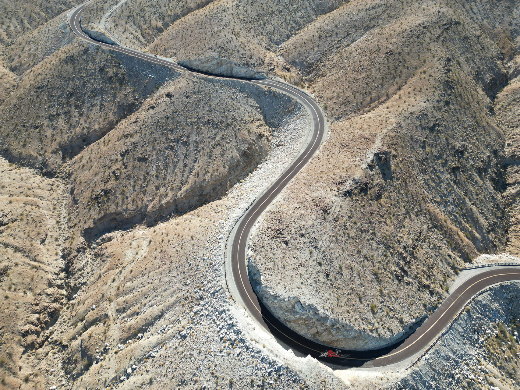
It’s 80-odd kilometres from Panamint Creek to Trona, starting out very straight… and then the road winds up from the valley floor and it’s like you’re on a racetrack again. Super-fast sweepers on a wide strip of bitumen with excellent visibility… just don’t f@ck-up, it’s a long way to a hospital.
I parked the bike near the top of the valley wall and got out my drone – one of those shots is currently my screensaver, the sinuous ribbon of bitumen contrasting with the dry landscape.
Trona California is a town named for the mineral found in its nearby lakebed, and a Godforsaken place from what I saw – there was nothing which looked welcoming for me to stop and spend money, and a lot of crumbling infrastructure and buildings. Turns out the population is in decline, the weather perpetually awful (cold winters, hot summers, little rain, no vegetation) and the kids have to play sport on dirt fields because the make-up of the soil kills grass. No redeeming features – I didn’t stop.
I was aimed at Barstow California, a small town outside LA which was only a couple of hours from Long Beach, where I needed to drop off the bike the following day. It’s actually on the old Route 66, which joined Chicago in the central north of the country to Los Angeles.
After the last few days Barstow felt like modern USA again, with wide roads, traffic lights and choices of restaurants…
Many people did the road trip after World War II as cars became cheaper and more reliable, causing services to pop up along the route. These days it’s more a historical anomaly than proper route, because interstate highways have replaced the route and bypassed the towns along the way.
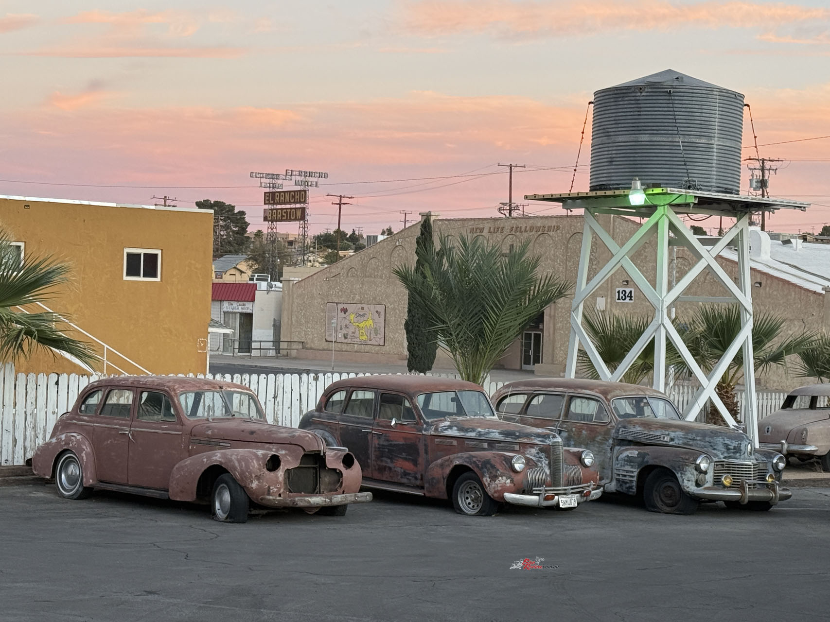
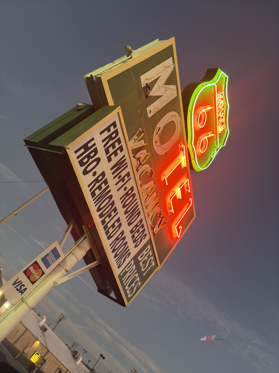
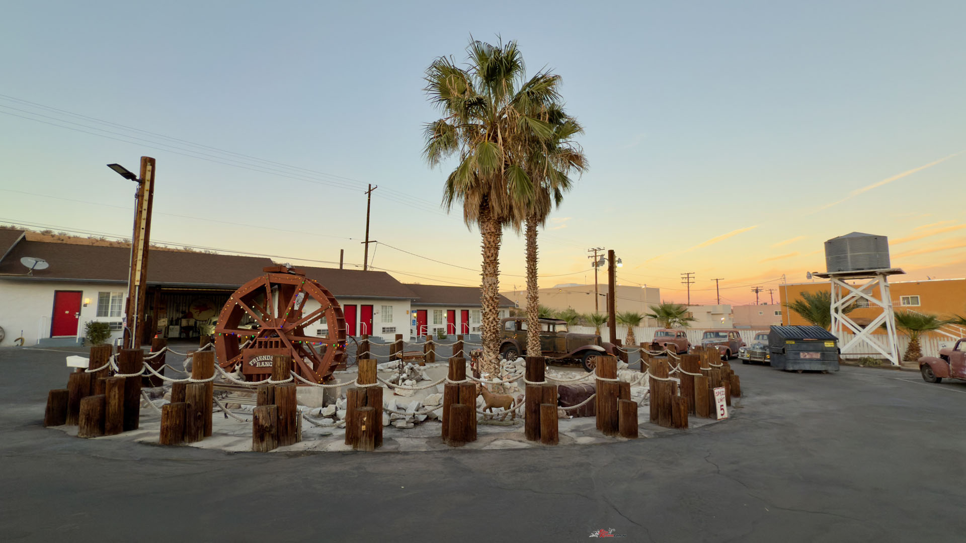
But I love the idea of a good road trip, and when I discovered the Route 66 Motel in Barstow was affordable and well reviewed I booked in. The owners have created a kitschy environment with some old cars and memorabilia of times when driving across the country was a lot tougher than in today’s appliance-like motor vehicles. After the last few days Barstow felt like modern USA again, with wide roads, traffic lights and choices of restaurants.


A little research that evening had me nervous about the following morning’s ride, back through LA – my two-hour ride was now looking like four if I wanted to arrive on time, and involved a lot of riding in heavily built-up areas. I played with the on-line map and realised I could go around (to the south-east) much of LA proper and not add more than a few minutes to the trip.
It actually turned out better than expected. By staying on the edge of LA and because I was riding a bike, I made much better time than the GPS thought I would, and my four-hour morning ride was over in three, and it had been far more enjoyable than I believe going through the city would have been, although I will say the freeways aren’t for the nervous or indecisive.
My California sojourn had turned out to be an incredible ride – fabulous roads, incredible scenery, (almost) faultless weather and no dramas. It was also bloody expensive – bike hire, accommodation and food – but that’s what you get when the Aussie dollar is worth US66c and the country is going through a cost of living crisis!
The Author
You Might Also Like