The Bear has been making his tracks through the spectacular rainforests of Barrington Tops and surrounding areas, check out his travel guide and get out there on your adventure machine!
The Gondwana rainforests in Australia include the most extensive areas of subtropical rainforest in the world and Barrington Tops National Park is a major part of the World Heritage Area which protects these forests. Turns out it’s an awesome riding location…
The Gondwana rainforests in Australia include the most extensive areas of subtropical rainforest in the world and Barrington Tops National Park is a major part of the World Heritage Area which protects these forests.
Gondwana was a supercontinent, assembled in the Late Precambrian time, some 600 million years ago. Its breakup began in the Early Jurassic Period, about 180 million years ago. Today, the remnants of Gondwana make up around two-thirds of the planet’s continental area.
Keep up to date with The Bear’s travels here…
The plateau that makes up Barrington Tops is only four hours north of Sydney by road, but it is remote and rugged enough to hold a mystery for more than 40 years. On August 9, 1981 a single engine Cessna 210 with five passengers on board disappeared over the Tops. The plane has not been seen again, making it the only aircraft to have gone missing on the Aus mainland that has never been found.
There are many reasons for “riding here” into Barrington Tops. For one thing, there are a couple of routes up from Sydney which take in some beautiful country on the way and keep you off the superslab.
“Tops” are remnants of plateaus in eastern New South Wales. Named, in this case, after some random Englishman – nobody seems to know which Lord, Lady or basset hound Barrington donated the name – Barrington Tops was the home of the Guringai people until the English dispossessed them. I can’t help but feel that if the Guringai still lived there they would have been able to find the plane.
“Gondwana was a supercontinent, assembled in the Late Precambrian time, some 600 million years ago. Today, the remnants make up around two-thirds of the planet’s continental area…”
There are many reasons for “riding here” into Barrington Tops. For one thing, there are a couple of routes up from Sydney which take in some beautiful country on the way and keep you off the superslab. Likewise, if you’re coming from the north you’ll find brilliant riding on the way – either on tar or gravel. Then there are the roads and tracks of the plateau itself, which range from the reasonably well maintained Barrington Tops Forest Road to fire trails, logging tracks in the State forest – not all of the Tops is national park – and four-wheel drive tracks.
You can go ages without seeing a township riding through the Tops, so it’s a good idea to be prepared prior…
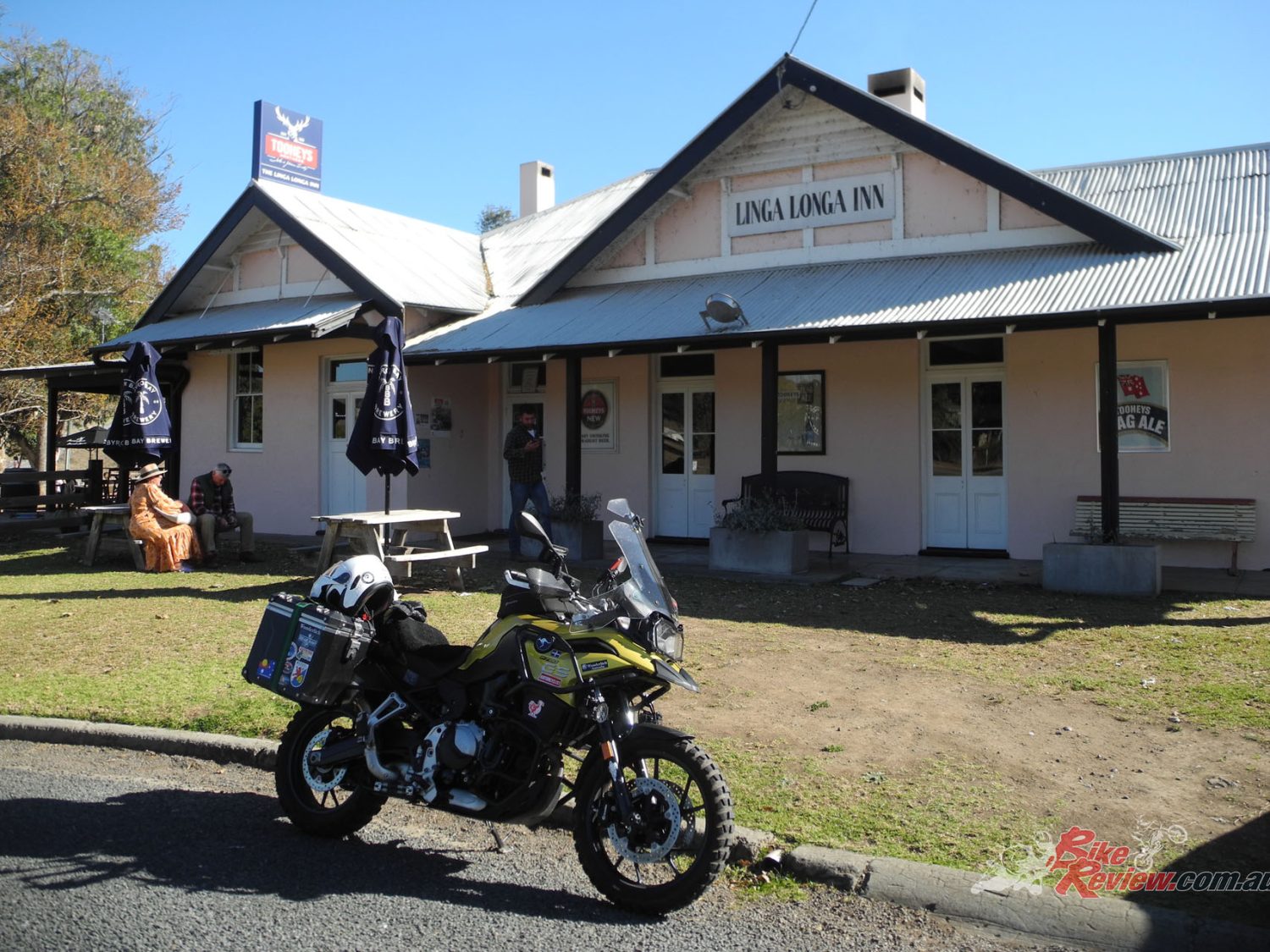
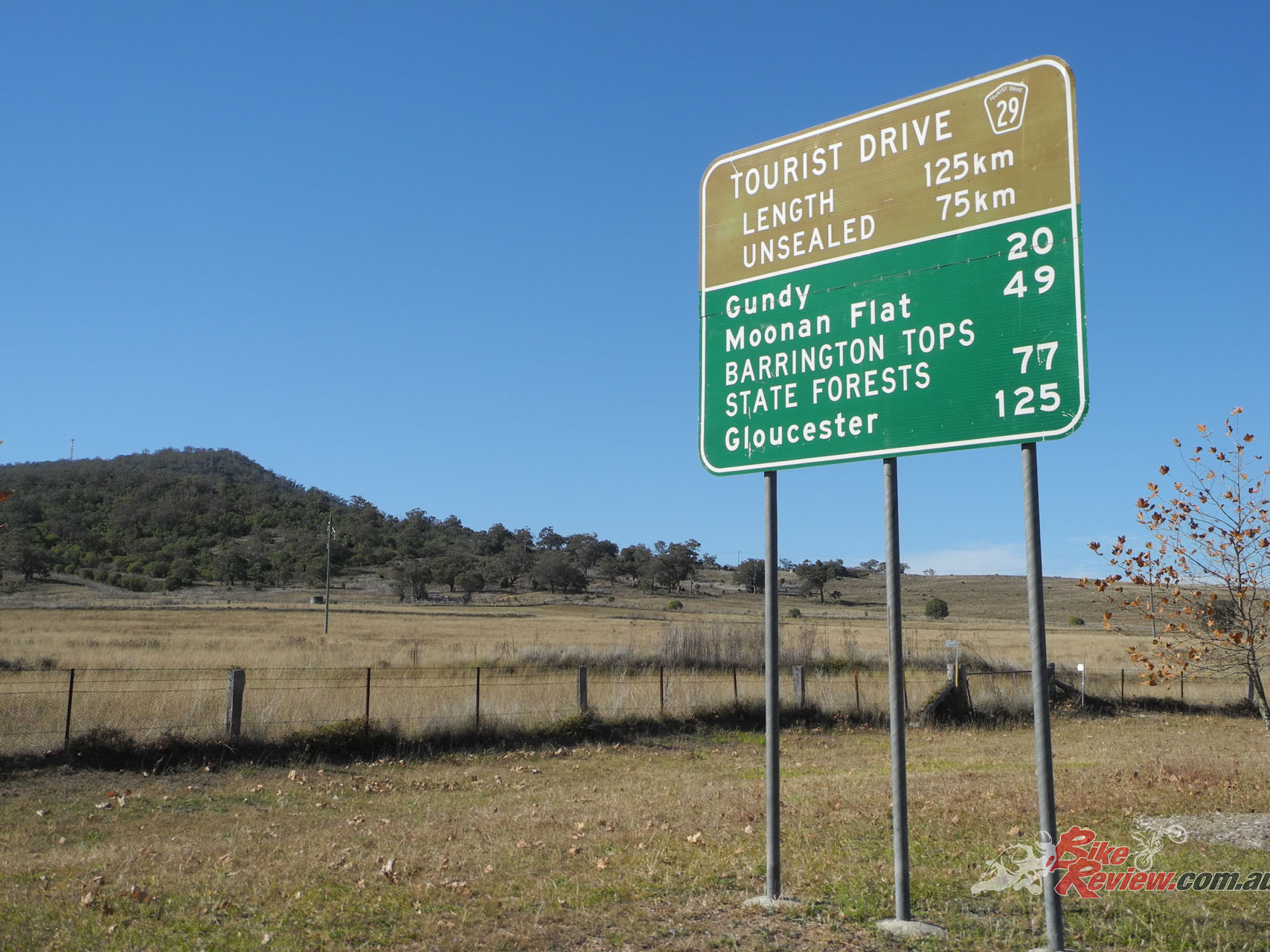
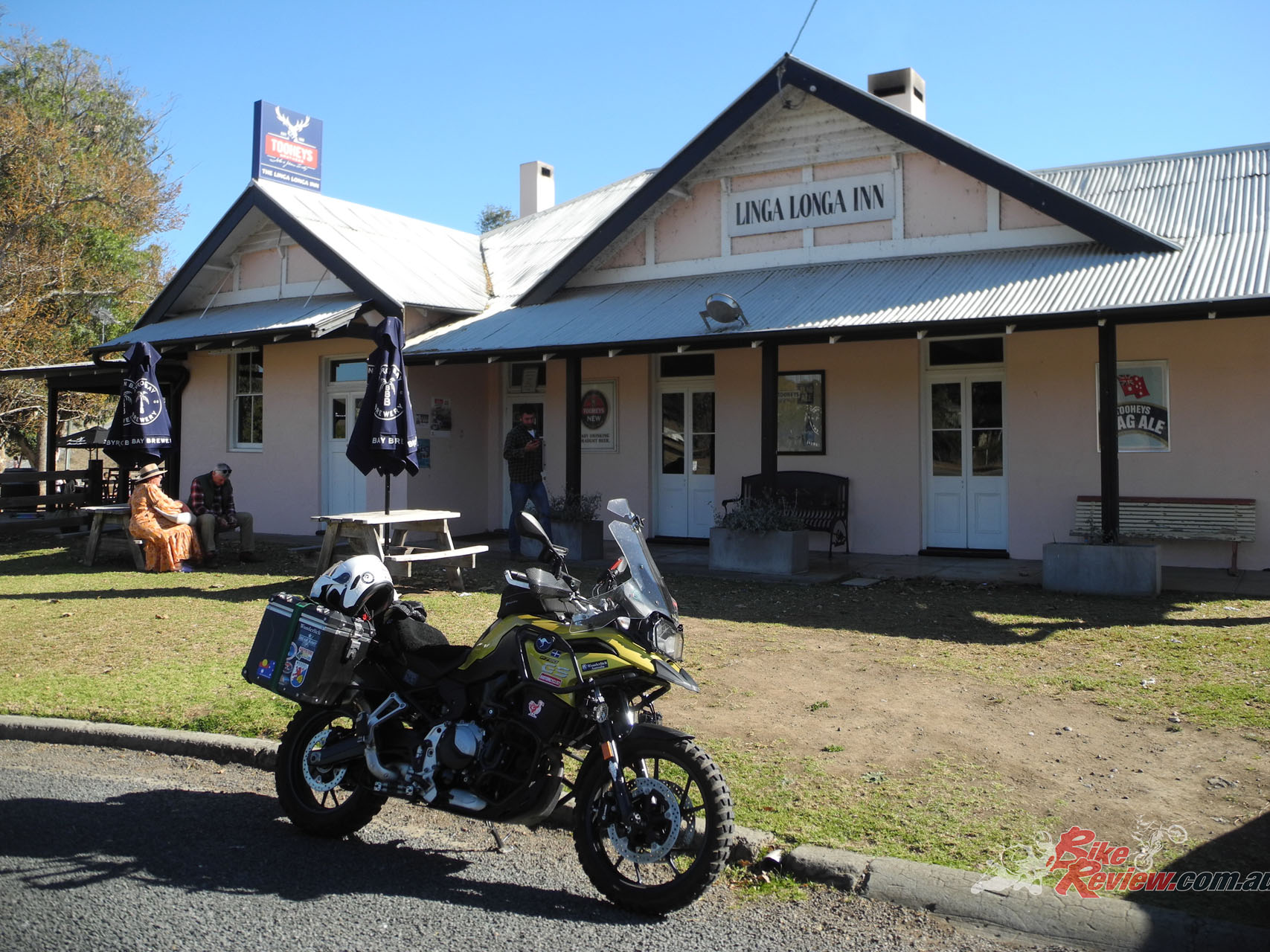
From the west, the easiest access is from either Scone or Aberdeen on the New England Highway. It’s an idea to fill your fuel tank before leaving the highway. The respective roads join at Segenhoe, one of those places that isn’t really a place. But don’t worry, not much further on is Gundy, which is definitely a place, even though a small one. It offers the Linga Longa Inn, a classic pub updated with a modern interior and a well laid-out beer garden. By country NSW standards the food is good.
“From the west, the easiest access is from either Scone or Aberdeen on the New England Highway. It’s an idea to fill your fuel tank before leaving the highway.”
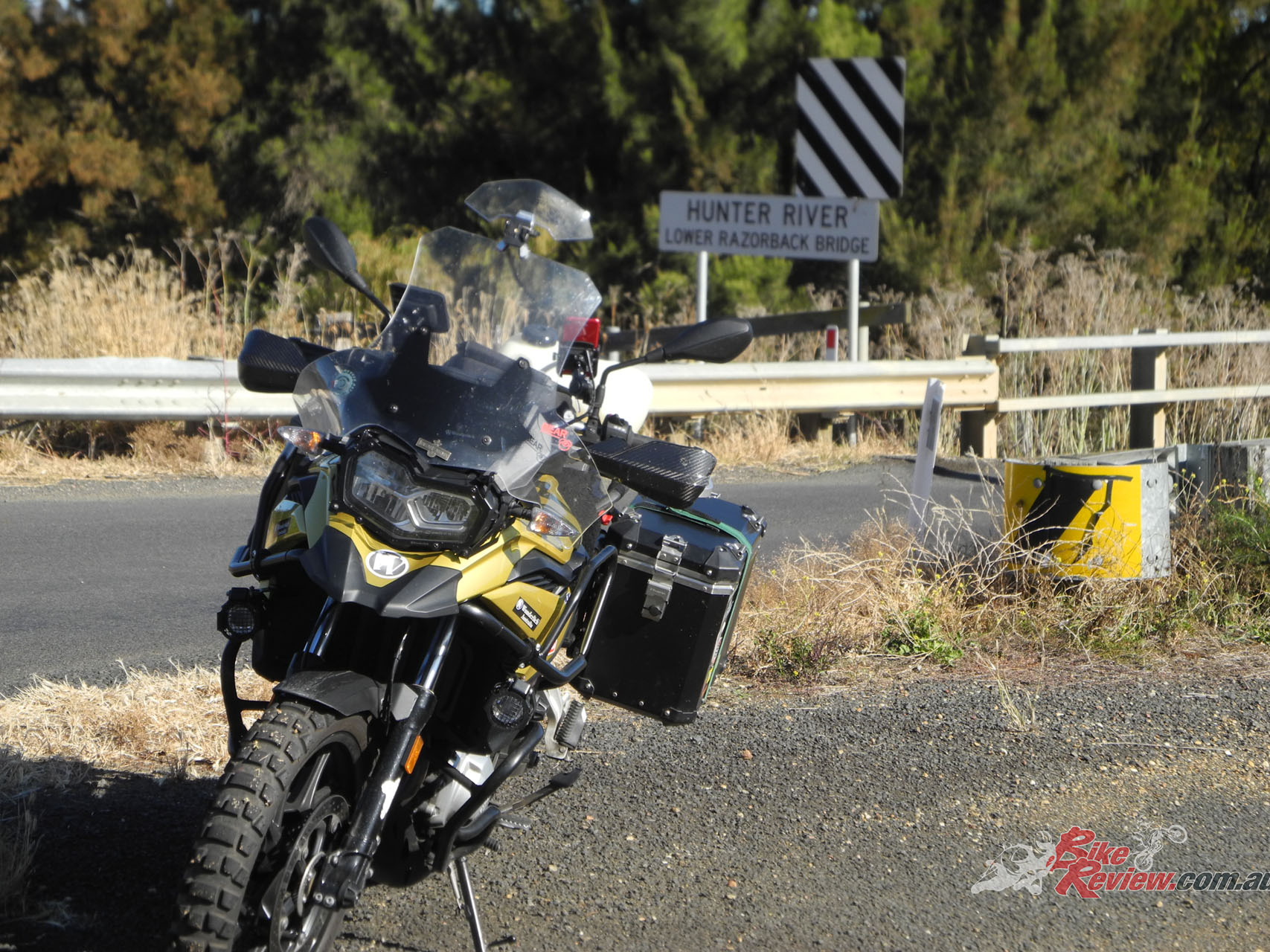
Continue along Hunter Road to Moonan Flat which also has quite a pleasant pub. Not far along, Hunter Road crosses Moonan Brook and Moonan Brook Road takes off to the right. A little further along again, you’ll find Barrington Tops Forest Road on the left. There has been some road work along here recently, but I suspect you’ll still find that this is gravel.
There’s such a huge amount of prehistoric land to cover, you don’t want to be stuck out there by yourself.
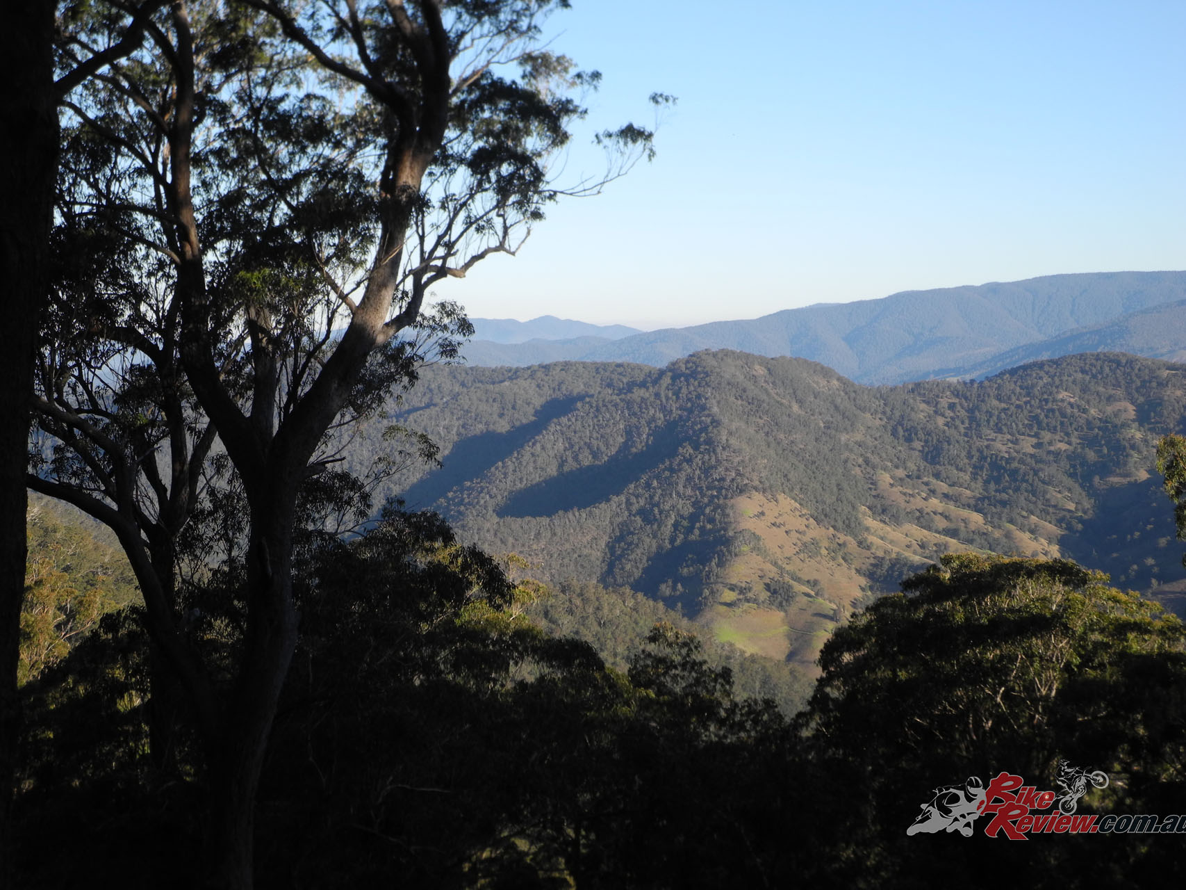
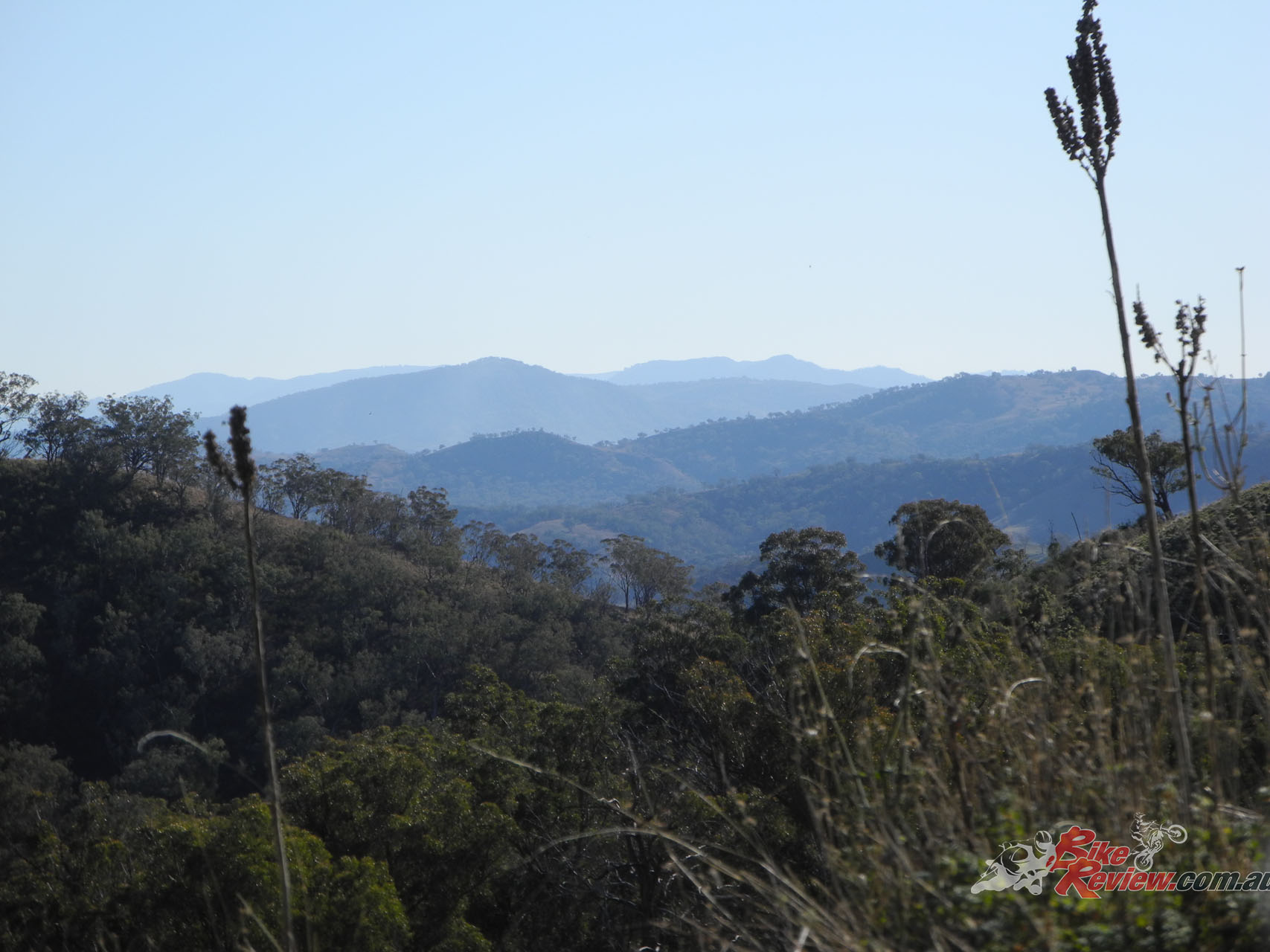
From here, the road twists and turns as it climbs the hillsides. The surface is reasonably good, and the few cattle grids don’t pose a problem, but the outstanding thing here are the views. In both directions you find yourself looking out over beautiful steep-sided valleys, hills staggered off into the far distance and an overwhelming feeling of tranquility. Stop and look at it. You won’t find the like in terribly many other places.
As you enter the national park, you’ll come to a dingo gate. Please close it behind you; farmers rely on it and the fence you’ll see stretching away to both sides for protection of their beasts. A little further along you’ll come to an unexpected fir plantation which holds a picnic area. There are several more picnic and camping spots along the road; please note that you need to book campsites. Thunderbolts Lookout (no, I didn’t miss the apostrophe, the Geographical Names Board has removed it) is worth a stop for the view over the ranges to the south-east.


An amazing number of tracks run off the Forest Road in both directions, either looping back or heading out to Scone Road and Tomalla if they are on the left. You’ll find that some of the tracks to the right are closed; that’s usually because they are quite badly degraded and need some rest. Actually, any of the tracks may be closed for that reason at any time. Just respect the need and go somewhere else.
The surface of the Forest Road is quite good all the way along, with only small changes depending on whether it is in the park, the conservation area or the state forest. Because log trucks use it where it runs through state forest (Oh, didn’t I mention the log trucks?) the surface tends to be smoother and slightly better maintained.
An amazing number of tracks run off the Forest Road in both directions, either looping back or heading out to Scone Road and Tomalla if they are on the left.
Eventually the road drops to the Cobark River flats, and as you come out of the forest you reach a junction where its name changes to Scone Road. This runs alongside the river through extensive grazing land. The place names you’ll find on the map are more wishful thinking than actual settlements. There are numerous road junctions, but all you have to do is follow the signposting which will take you past Copeland Tops to Thunderbolts Way at Barrington. You’ll find fuel here, and Gloucester is only a few kilometres away.
My recommendation there is Roadies Café on the main drag, Church Street. Good and interesting food at reasonable prices and quick service. The Roundabout Inn, at the roundabout (predictably enough) is also quite good. You now have a decision to make: do you go south on the Bucketts Way towards Sydney, or east to Nabiac with its motorcycle museum on the other part of the Bucketts Way? It’s buckets to buckets, and you won’t regret either choice because the upgrade of the road is finally happening, and should be just about complete by the time you get there.
Editor’s Note: If you are reading this article on any website other than BikeReview.com.au, please report it to BikeReview via our contact page, as it has been stolen or re-published without authority.
The Author
You Might Also Like